About Our City "KAYALPATNAM"
Our City name is kayalpatnam. Kayalpatnam is an ancient historical city of India. It lies in the southeast part of Indian peninsula, on the shore of the Bay of Bengal. It is a Muslim dominant town situated in Thoottukudi district and formally it was in Tirunelveli district. It is about 400 miles from Madras and 100 miles from Thiruvananthapuram and Madurai.
History of Kayalpatnam
Kayalpatnam is an ancient historical city of India. It lies in the southeast part of Indian peninsula, on the shore of the Bay of Bengal. It is a Muslim dominant town situated in Thoottukudi district and formally it was in Tirunelveli district. It is about 400 miles from Madras and 100 miles from Thiruvananthapuram and Madurai.
Kayalpatnam was chief trade emporium even before the advent of Islam and it was chief port of Mabar to which Arabs and Greeks were frequent visitors. During the lifetime of our beloved holy prophet Muhammad (Sal.) Islamic missionaries were sent to Mabar to preach the peace mission of Islam. The first settlement in Kayalpatnam occurred in 633 A.D. (Hijiri 12). The first settlers were from Mecca and Medina and landed here during the reign of the first caliph, the successor of our prophet Muhammad (Sal), Ameerul momeneen Hazarat seyedna Abubakar Siddeeq (Rali).
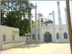
According to the eminent Historians, Greeks, Romans and Arabs visited Kayal even before the advent of Muslim missionaries of Arabia. Through our ancient saintly scholars' records, we made out the first Muslim settlement in Kayalpatnam happened during the lifetime of Hazarath Abu Bakar Siddeeq (Rali). Kadal Karai Palli was the first mosque and added saints who ever visited Kayalpatnam never missed to pray at this mosque. The second settlement took place in 842 A.D. (Hijiri 227). They came from Cairo in Egypt during the tyrannical rule of Abbasid caliph Al-Multhazim (841 A.D.) and the beginning of caliph Al-Wadiq's rule, (842 A.D.), under the leadership of Muhammad Khalji (Rah). Big Jamiah mosque (Kuthba Periya Palli) was built by Muhammad Khalji in 843 A.D. (Hijiri 228).
Kayal was the name of the place till the advent of Muhammad Khalji. After his arrival, the southern part of kayal is named as Kahirfathan after the name of his own town "Kahira" in Egypt. Kahirfathan in Arabic is slowly changed into Kayalpatnam in Tamil. The northern part of Kayal is called palaiya Kayal and Punna Kayal.
The third batch of Arabs (third settlement) came from Arabia in 1284 A.D under the leadership of Sultan Jamaluddin, who was a descendant of holy prophet Muhammad (Sal.), a business magnate, a statesman and a famous ruler of Pandiyan kingdom. His descendants are still living in Kayalpatnam and they have their genealogical table from Sultan Jamaluddin. Indian historians and many famous foreign travelers and historians of the west perfectly made known that Kayalpatnam is situated near the Tamira Parani river about a mile from its mouth in Tirunelvelli district presently Tuticorin district and Kayalpatnam is also distinctly identified with Islam from 8th century. Kail, was long a famous port on the coast of what is now the Tirunelveli district of the Madras presidency. It is mentioned as part of Mabar by Polo's contemporary Rashiduddin. Kail is definitely the one situated on the Tamraparani River about 1 & half miles from its mouth. (Travels of Marco polo translated by Sir Henry Yule).
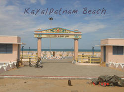
Kayalpatnam Beach
Famous travelers and historians like Abdullah Wasaf, Rasheeduddin, Ibn Batuta and Marco Polo gave some information about Kayalpatnam in their books. The works of Dr. Rev. Bishop Caldwell, Sir Elliot, Col-Henry Yule, Sir John Emerson Tennant, Sir Simon Casio Chitty and Sir Ponnambalam Ramanathan, incidentally, the latter mentioned six writers, substantiate, the view that the Arabs had settled first at Kayalpatnam and there from spread to the other parts of eastern coast of India and Ceylon.
A historical Atlas of South Asia edited by J.E. Schwartzberg, University of Chicago press, Chicago, printed in 1928, shows that famous Korkai and Kayal were situated on the delta of the Tamira Parani. Bishop R. Caldwell writes in his book "History of Tirunelvelli" that both places are situated on the delta of Tamira Parani. Korkai within five, Kayal within two miles on the sea but each was originally on the seacoast.
A well known Indian historian K.A. Nilakanda Sastri narrates in his book "History of south India" that once the wealthy commercial cities of Korkai and Kayal on the Tirunelvelli coast, which were flourishing in thirteenth century are now buried under sand dunes miles from the sea. According to Vascodagama, Kayal was on the Tirunelvelli coast where pearls were found. It was under Mussalman King. (His book - Reteriro)Travelers like Masudi and Ibn Batuata testify to the presence of Muslims and mosques all along the west coast. There were Muslim settlements on the east coast of which Kayalpatnam and Nagore were the most important. (History of India - Nilakanda Sastri) Maps showing Religious movements on the 8th to 12th centuries in India published by Menesto University in U.S.A., in which Kayalpatnam and Nagore are identified with Islam. According to Abdullah Wassaf, a Persian historian, a contemporary of Marco polo Kayal was the port of Mabar. During the reign of Mabar king Sultan Shaik Mabar, his administrative office was at Kayalpatnam. He died on Hijiri 628 (1231 A.D) and buried here. His tomb is near panchayat board very close to the house of Sahib Thambi Alim, former principal of Mahalara Arabic College on the way to Koman Street. Descriptions were given in Arabic on the tomb.
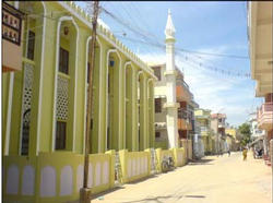
New Mosque
If you want more information about our city, Click www.kayalpatnam.com


